You are here: Geosciences Cartography  
 GEOSCIENCES
Analytical and Ecological Chemistry
Biogeography
Cartography
Climatology
Ecotoxicology
Geobotany
Geology
Geomathematics
Hydrology
Remote Sensing
Soil Science

CARTOGRAPHY
 

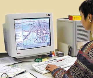
The discipline of cartography within the network of the geographical and geoscientific disciplines deals with the graphic, visualisation and communicative processing and presentation of geospatial information.


In the department of cartography interdisciplinary methods of cartographic information processing within geospatial information systems are examined. Theory and modelling of the use of these media as well as methods and procedures for their production are main parts of cartography.

A special emphasis of the department of cartography at the University of Trier is the application of cartographic information processing in geography, geosciences, and environmental sciences.


Equipment

· Laboratory of cartographic information processing (incl. four servers and 25 work stations)

· Laboratory of experimental cartography (incl. six work stations and 2 eye-movement-recording systems)

· Laboratory of geovirtual environments (incl. 8 graphic workstations and 2 VR-presentation units with position-tracking, head-mounted display and stereographic presentation wall


Study and Research Topics

· Cartographic information processing for the use in the fields of geography, geosciences and environmental science

· Cartographic control of geographic information processing

· Rule-based cartographic control and leading systems

· Cartographic communication and project management

· Perception and cognition research of cartographic system use and control


Selected research projects
1995 - 2003


· Development of rule-based methods for cartographic communication in geographic information systems

· Encyclopaedia of Cartography and Geomatics
In the period 2000-2002 the publication of the Encyclopaedia of Cartography and Geomatics strived for summarizing the scientific cartographic knowledge in Germany caused by the considerable change of the scientific and technologic cartography and its widening into new fields of basics and applications.

· Virtual Reality Laboratory / VR
The laboratory comprises the installation of a VR-visualisation equipment for modelling and presenting virtual landscapes. Until now this technology for visual representation of reality has not been a focus of research in cartography. For this reason research will start to develop suitable models for this modern form of processing spatial information, this research will be widened with methods of the empirical cartography. The laboratory can also be used to introduce students in VR-basics and to teach them to develop their own VR-projects.

· Virtual Petrisberg
In cooperation with the “Landesgartenschau Rheinland-Pfalz 2004” a virtual model of the exhibition site “Petrisberg” will be developed and a virtual landscape show will be presented to the visitors during the exhibition period. In part the virtual landscapes will show perspectives and angles to the visitors which are not directly accessible to them, in part the VR-visualisations will give an idea of the development of the Petrisberg area through history. Later it will be researched and reported on the extend to which new media are accepted by the public.

Teaching

The basic courses provide an introduction to modern cartography. During the senior courses these basics can be developed. Teaching is focussed on

· map conception and map use based on system and model theories

· analysis of information processes by electronic media based on perception and communication theories, and

· basic network and processes of cartographic informatics

A range of lecturers from Experimental Cartography, Applied Cartography or Cartographic Information Processing is offered during a project study.

The teaching programmes include topics like

· empirical methods for examining cognitive processes

· empirical examination of visual information process

· data and symbol modelling

· conception and realisation of cartographic systems

· principles of cartographic media use

· development and application of cartographic media concepts.

Subjects of the last project studies:

· cartographic communication within virtual space

· sign models for virtual landscapes

· modelling of dynamic maps concerning problems with supply and waste management


Head of Department
Prof. Dr. Jürgen Bollmann
E-Mail: bollmann@uni-trier.de
+49 (0) 651-201-4561

Staff
Dipl.-Geogr.Dr. Andreas Müller
E-Mail: muellea@uni-trier.de
+49 (0) 651-201-4576

Dipl.-Ing. Stefan Kühn
E-Mail: kuehns@uni-trier.de
+49 (0) 651-201-4563

Dipl.-Geogr. Wilfried Weber
E-Mail: ww@uni-trier.de
+49 (0) 651-201-4566

Secretary
Anne Menkhaus
E-Mail: menkhaus@uni-trier.de
+49 (0) 651-201-4561

Contact:
Homepage Cartography
E-Mail: kartographie@uni-trier.de